
You probably saw the news: Cyclone Montha has hit the coastal part of India, especially Andhra Pradesh. People woke up to very heavy rain, strong winds, and roads full of water. For some, it felt scary. It just shows how weather can be hard to guess. We need to talk about everything in this article: how the storm started, where it went, what the weather office (IMD) said, and what people should do right now.
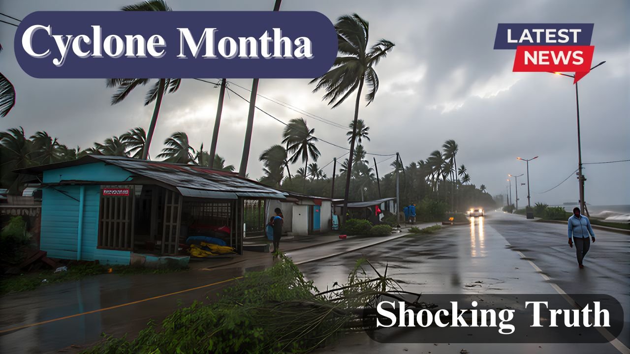
Table of Contents
About Cyclone Montha?
Cyclone Montha is a strong storm that formed over the Bay of Bengal. It started as a small depression but slowly grew into a severe cyclonic storm. The warm sea temperature gave it power. When such storms grow fast, they bring heavy rain, thunder, and strong winds.
According to IMD, the cyclone got its name “Montha” as part of the naming system followed by countries around the Indian Ocean. The name might sound calm, but the storm surely was not.
The cyclone made landfall near the Andhra Pradesh coast. That means it moved from the sea onto land, carrying heavy rain and fast winds with it. This caused damage to trees, electricity poles, and some houses near the coast.
Where And When did Montha Hit?
Cyclone Montha hit Andhra Pradesh on Tuesday morning. The exact landfall point was near Bapatla, which is close to Guntur and Vijayawada. The wind speed during landfall was between 90 to 110 kmph — strong enough to uproot trees and bend electric poles.
You can also track the cyclone on Windy.
Here’s a simple table to help you understand the basic details of the cyclone:
| Detail | Information |
|---|---|
| Cyclone Name | Montha |
| Origin | Bay of Bengal |
| Landfall Location | Near Bapatla, Andhra Pradesh |
| Landfall Time | Early morning, Tuesday |
| Wind Speed | 90–110 kmph |
| Affected States | Andhra Pradesh, Odisha, Telangana |
| Issued By | India Meteorological Department (IMD) |
This table gives you a quick look at how powerful and wide the storm was.
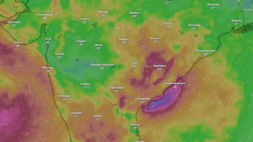
How The Weather Changed After Landing?
After Cyclone Montha made landfall, heavy rain started in many areas — especially in Vijayawada, Guntur, and nearby districts. Roads got flooded, trees were uprooted, and the power supply was cut off in many towns.
People in low-lying areas had to move to safer places. Schools were closed for a few days. Trains were delayed. Even the airports in nearby regions stayed on alert.
But there’s some good news too — the cyclone slowly weakened after landfall. Once it moved inland, it lost power because land doesn’t give it the same energy as the sea. IMD confirmed that it turned into a deep depression within a few hours.
IMD’S Warning and Weather Forecast
The India Meteorological Department (IMD) had already warned people days before the cyclone hit. They asked fishermen not to go into the sea and told the local government to prepare shelters.
Here’s what IMD said in simple terms:
- Heavy to very heavy rain expected in Andhra Pradesh, Odisha, and Telangana.
- Strong winds up to 100 kmph near coastal areas.
- Sea conditions rough and dangerous for fishing boats.
- Flood alerts in low-lying areas.
Even after the cyclone weakened, IMD warned that leftover rain clouds could bring more rain in nearby states. That’s why the weather in Hyderabad and Odisha also stayed cloudy and wet for the next two days.
Effect On Andhra Pradesh and nearby Areas
Andhra Pradesh was the most affected. Vijayawada, Bapatla, and Guntur faced heavy rain and strong winds. Many small shops and roadside stalls were damaged. A few trees blocked main roads, and rescue teams worked hard to clear them.
Odisha and Telangana also saw strong rainfall. Some flights were delayed, and local trains ran slower than usual. The good thing is — because IMD gave early warnings, most people stayed safe indoors.
The government also set up control rooms, arranged food and water supplies for those affected, and sent rescue teams to coastal villages.
What People Are Saying?
Locals say this cyclone reminded them of past storms like Titli and Fani. People shared videos online showing strong winds, flooded roads, and rescue workers helping families. Many said they were scared but thankful that it passed faster than expected.
In some areas, kids were seen playing in the rain once it became lighter. It’s strange how a scary storm can bring both fear and relief at the same time.
Safety Measures During Cyclones
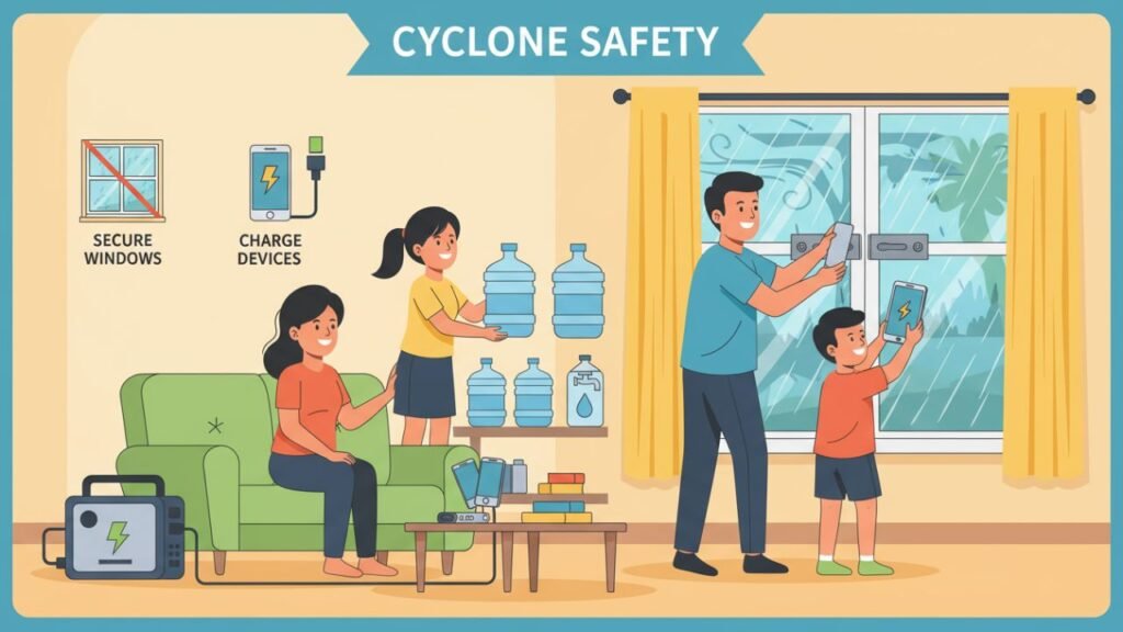
When a cyclone hits, the best thing to do is stay calm and follow safety rules. Here are a few simple things everyone should remember:
- Stay indoors and avoid going near windows.
- Keep your mobile phones charged.
- Store drinking water and dry food.
- Don’t touch electric wires or fallen poles.
- Listen to local weather updates.
- Move to higher ground if your area floods.
These small steps can save lives during such situations.
Why Such Cyclones Happen Frequently?
In recent years, the Bay of Bengal has seen many cyclones. The reason is simple — the sea surface is becoming warmer. Warm water gives storms more power. That’s why cyclones are forming faster and becoming stronger.
Climate experts say that global warming is making weather patterns unpredictable. That’s why sometimes we see floods in one part of India and droughts in another. Nature is trying to balance itself, but humans have changed too much around it.
How Technology helps in Saving Lives?
One positive thing about this cyclone is that people got time to prepare. Thanks to modern weather technology, IMD tracked the storm’s movement every few hours. Satellite maps and live trackers helped authorities predict where it would hit.
This helped local governments to:
- Warn people early.
- Move families from coastal areas.
- Stop fishing and shipping for a few days.
- Keep hospitals ready for emergencies.
Because of this planning, the loss of life was much less than what could have happened years ago.
Current Weather and Next Few Days
Right now, the cyclone has weakened, but heavy rain is still expected in parts of Andhra Pradesh, Odisha, and Telangana. The weather in Hyderabad will stay cloudy with light rain.
IMD has said that the worst part is over, but people should stay alert for one more day because leftover clouds can still bring rain.
After two or three days, the weather will likely become normal again. Farmers, however, might face some trouble because excess rain can damage crops.
Small lessons From Cyclone Montha
Every cyclone teaches us something. This time, it showed how early warnings and teamwork can save lives. It also reminded us to take nature seriously. We can’t stop a storm, but we can prepare for it.
It also made many people realize the importance of planting trees and keeping the environment balanced. A healthy planet can reduce the power of such storms in the future.
Our Thought
Cyclone Montha was strong but short-lived. It hit Andhra Pradesh hard but then weakened quickly. The IMD’s quick warning and people’s cooperation helped control damage. Heavy rain, strong winds, and flooded roads were the main effects, but life is slowly getting back to normal.
Let’s hope that everyone stays safe and that future storms can be handled even better.
Disclaimer: This article is for general information based on updates from weather reports and news sources. Weather situations can change quickly, so always follow official IMD alerts and local government instructions for safety.
Also Read:


Hey there! Spent a bit of time on vn88io lately. Gotta admit, I was a bit skeptical at first, but overall I found it to be a solid platform. The game selection’s pretty good, especially if you’re into slots. Withdrawal times could be a little faster, but not terrible. Check them out here vn88io.